SPACEFLIGHT Earth observation satellites

Private eyes on Earth

Once a domain of governments and militaries, satellite Earth observation today has seen these existing players joined by a vibrant influx of new commercial space start-ups pushing innovation to the limits. TEREZA PULTAROVA reports.

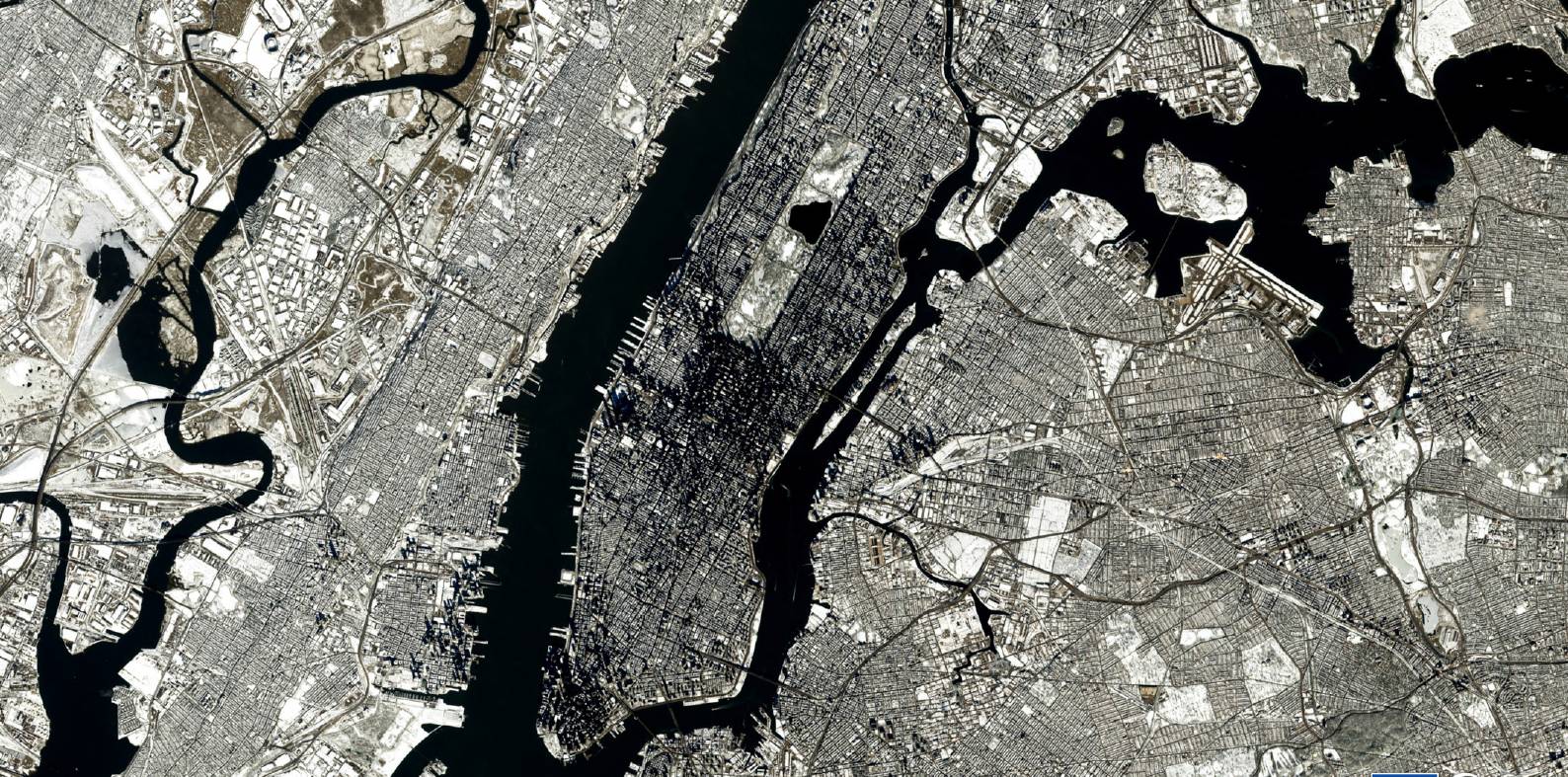
New York in the snow, as seen from a Copernicus satellite. ESA

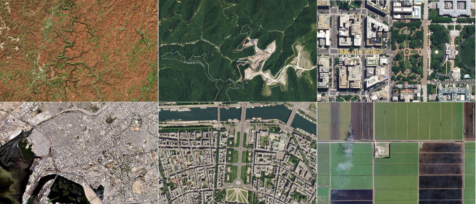
It is a benchmark used by Earth observation companies to showcase their abilities – counting cars in parking lots from space using artificial intelligence algorithms that automatically analyse images acquired by Earth observation satellites.

Retail chains can use this information to gauge differences in the performance of individual stores and shopping trends over time. Wealthy investors, who can afford the data, can predict the chains’ performance and buy or sell their shares ahead of quarterly reports, according to a study by scientists from UC Berkeley and the University of Kentucky.

In May 2020, Harvard University researchers counted cars in satellite images of hospital car parks in Wuhan, China. Based on the increased traffic compared to previous years, they concluded that the Covid-19 pandemic may have started months earlier than had been officially claimed.

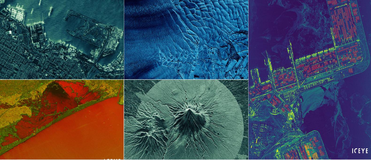
However, there are other things that can be counted and monitored from space too, as long as they are large enough to be distinguished in images with 30-50cm resolution: the growth of refugee camps and illegal mines, the impact of natural disasters and the missile development effort by adversaries. Just recently, British zoologists demonstrated that satellite images can be used to monitor populations of endangered African elephants.

There is also a lot more you can do with space data today – measure CO2 2 concentrations in the atmosphere, identify methane leaks from gas infrastructure or detect air pollution produced by individual ships at sea.

Earth on film

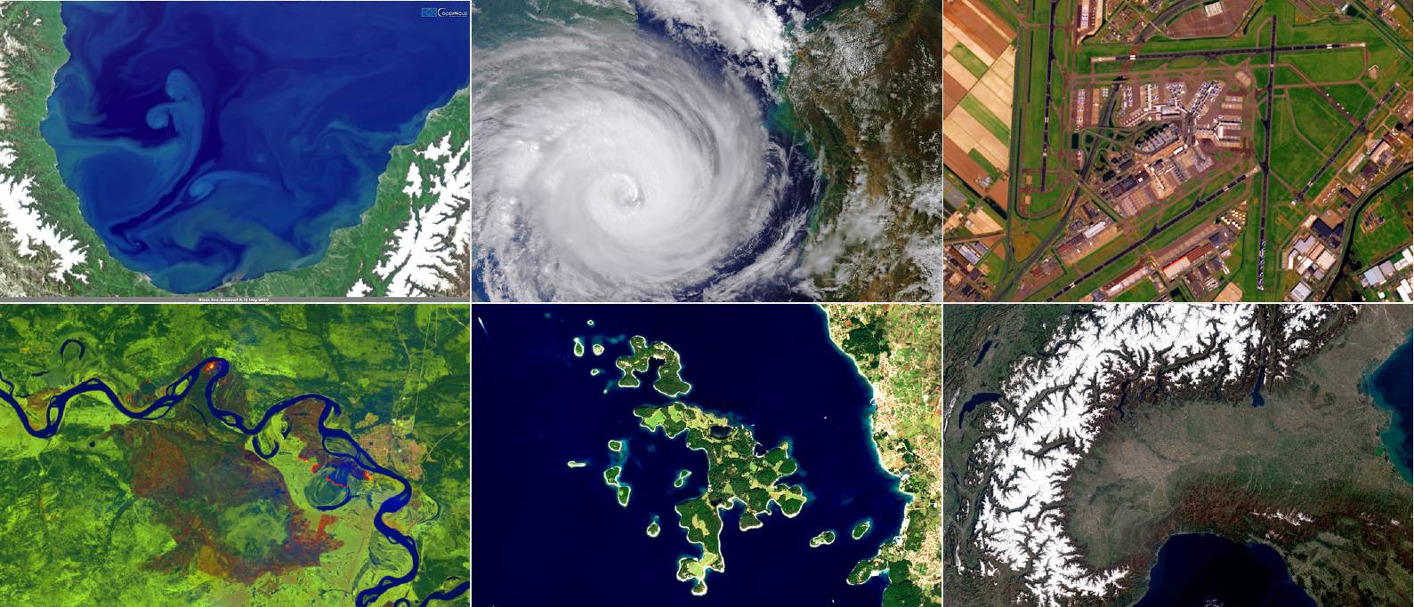
The planet today is under permanent surveillance by hundreds of Earth observation satellites carrying various kinds of sensors and the number is only expected to grow.

“We expect that more than 1,000 Earth observation satellites could be launched over the next decade,” says Dallas Kasaboski, Senior Analyst at Northern Sky Research, a US-headquartered satellite industry consultancy. “The Earth observation sector has experienced a massive transformation over the past decade, shifting from a small number of large satellites providing images of a single place on Earth at best every week to the constellations of dozens of smaller satellites that we see today capable of daily revisits.”

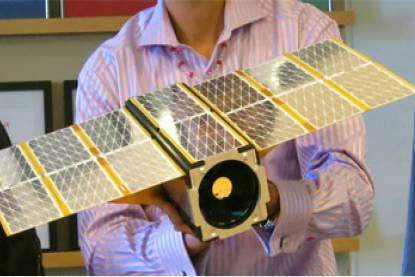
A Planet Labs Dove imaging CubeSat. This is not a scale model but the size of the actual satellite. Planet Labs

Ten years ago, government organisations, militaries and large wealthy companies, such as those in the oil and gas sector, would buy single images from a handful of providers. These providers, the likes of Airbus and DigitalGlobe, would operate small fleets of large and expensive satellites that took years to develop and build.

Human analysts would then pore over every precious image looking for anything of interest to their employers. Then came the new space revolution, driven by advances in digital technology. Components became cheaper, smaller and lighter and, suddenly, it was possible to fit a small satellite, or even a CubeSat with decent sensors, capable of obtaining useful images or measuring various aspects of the Earth’s environment.

“Ten years ago, you might have had a sensor that would be one metre long,” says Kasaboski. “These days, the sensors are much smaller, so you can put them on smaller satellites, which are cheaper to launch. The miniaturisation trend started with optical instruments. However, we can now also see it in radar, which used to be very large and expensive and mostly the domain of the military but now they are becoming smaller too.”

Nowadays, Finnish company ICEYE is one of those developing synthetic aperture radar instruments that can fit on satellites of less than 100kg in mass. Its ICEYE-X1and ICEYE-X2 satellites can capture 1m resolution radar images of the Earth’s surface day and night and through the clouds. The company’s ultimate goal is to build a constellation that would be able to image each spot on the Earth every hour.

There are other start-ups readying to compete with ICEYE. American Capella Space launched the first satellite of a planned 36-strong SAR constellation in 2019 and Canadian UrtheCast had been known to have similar plans before the Covid-19 crisis struck.

Images taken from ICEYE SAR satellites. Clockwise from top left: the Port of Alexandria, the main port in Egypt; the Thwaites Glacier, Antarctica; Stockpiles seen and measured from ICEYE very high resolution SAR imaging at the port of Bayuquan, China; ICEYE radar satellite image from Mount Taranaki, Stratford, New Zealand; and flooded fields around the Lake Albufera in Valencia, Spain.

Planet Labs’ view

The one company that has almost become synonymous with the Earth observation revolution of the past decade, however, is San Francisco-based Planet Labs. Founded in 2010 by three former NASA engineers, Planet Labs (or Planet), built its first satellite, Dove 1, in a garage in Cupertino and launched it aboard Russia’s Soyuz rocket in 2013. Since then, Planet has grown into a multi-faceted leader and a pioneer. Its fleet, which today comprises more than 150 satellites (prior to the launch of SpaceX’s Starlink, the largest constellation ever), can image every spot on the Earth every day, opening new avenues for applications that were previously impossible.

​“Planet really delivered a huge push to the sector,” says Kasaboski. “They pushed for a large constellation, they were the first to image the globe on a daily basis and they have been a leader at pushing new ideas into Earth observation ever since.”

Developed through the agile aerospace philosophy of rapid testing and iteration, the Dove platform at the heart of Planet’s constellation is about the size of a loaf of bread. Each Dove carries an optical imager that photographs the Earth’s surface with three-metre resolution.

In a blog post published in January 2020, the company’s co-founder and Chief Strategy Officer, Robbie Schingler, said that, over the past decade, Planet has reduced the cost of reaching space by a factor of ten and proved that satellites can be built at 1,000 times lower mass and cost than was considered the norm previously.

That, however, does not mean the large government-funded technology is dead. The larger satellites, albeit dispatched in much lower numbers, can guarantee better accuracy and provide higher resolution images of up to 30cm. Military technology might be capable of even better resolutions, but data of such quality is not commercially available.

Images taken from Planet Labs’ satellites, clockwise from top left: New River Gorge National Park, Fayette County; Taywood West Surface Mine, Mingo County, West Virginia; Black Lives Matter Plaza NW, Washington, DC; Karachi, Pakistan, West Virginia; Picnickers on the Esplanade des Invalides, Paris, France and sugar cane field burning, Palm Beach County, Florida. Background previous spread: Copacabana, Rio, Brazil.

Copernicus

​Alongside the commercial new space Earth observation developments, one of the key Earth observation projects of the past decade has been Copernicus, an Earth observation programme of the European Commission, carried out jointly with the European Space Agency (ESA). With currently eight satellites in orbit, designed to monitor various aspects of the Earth’s environment, the programme delivers data for free to users all over the world with the goal of making Earth observation insights accessible and useful in sectors that would not have naturally used them in the past.

“A lot of novel applications and services have appeared where our data is just included and becomes in terms of its source, a commodity,” says Nicolaus Hanowski, Head of the Mission Management & Ground Segment Department at ESA. “The overall availability of data has increased; the user community has also increased and is now ranging from specific scientific user groups to products that big information companies, such as Google, are generating in which Earth observation data is seamlessly integrated in the same fashion as navigation data.

Free view benefits

Ten years ago, Hanowski says, Earth observation missions operated by the space agency would generate 20 to 30 times more data than would get eventually downloaded by users. Since then, the trend has completely reversed.

“Today, every data product that is generated, is on average downloaded 20 to 30 times,” says Hanowski. “Just from our ESA hub, we distribute about 250 terabytes of Earth observation data per day. If you would put this on to discs, you would actually reach the height of the Eiffel Tower.” The commercial players and Copernicus, with its free data, learned to coexist quite successfully over the years and even benefit from each other’s existence.

“Copernicus is fantastic for users that are happy with 10m resolution data delivered some time between 6 and 12 days,” says Kasaboski. “The free data has pushed the prices down in the medium-resolution part of the market, which has had an effect on revenues of medium-resolution data providers. However, it has facilitated a shift from selling single images to monitoring and subscription services.” Thanks to the availability of free high quality data, many new companies have emerged on the downstream side creating artificial intelligence algorithms and analytics software for various applications, from forest monitoring to identifying best locations for solar farms and measuring thermal behaviour of cities.

OVER THE PAST DECADE THE COST OF SATELLITE IMAGERY HAS BEEN CUT IN HALF

Artificial intelligence, Kasaboski says, is the future of Earth observation. The amount of data produced today is such that human analysts can no longer serve as the main processing power. “We still see some human-led analysis but there is a shift towards automation, towards software-driven analysis,” says Kasaboski. “The computers can handle many images at the same time, even images from different satellites or images acquired many weeks apart.”

Planet, for example, aims to develop an artificial intelligence system that would use the company’s images to find and index physical change on the Earth in the same way that Google indexes the internet. Ultimately, users would be able to query how many ships there are in Mediterranean ports or how many new houses have been built in Pakistan. 

While, in the past, users would purchase single images, most companies now offer subscriptions that bring the price of a single image down, delivering updated images to users as soon as those become available. “Over the past decade, the cost of satellite imagery has been cut in half, thanks to the arrival of new players,” says Kasaboski. “The subscription model is pushing that down even further. For example, Planet’s agreement with the US National GeospatialIntelligence Agency called for delivery of millions of square kilometres of imagery. If it had charged the normal prices of $3 to $15 square kilometres for medium or high-resolution optical imagery at the time, the contract would have ended quite quickly.”

Satellite imagery, Kasaboski admits, is still much more expensive than alternatives, such as drone or aerial photography, on a per square kilometre basis. “Of course, if you want a much larger area or more immediate access, satellite imagery has advantages there,” Kasaboski says.

Kasaboski sees the future in what he calls the ‘Netflix model’ – a subscription-based service, combining data from multiple operators, various resolutions and even different sensors in a unified platform, akin to the American content streaming service. Not only would such a service likely reduce prices even further but it would also add convenience for users who today frequently have to shop with multiple providers, acquire multiple subscriptions or solicit the help of third-party companies.

“From a technology standpoint, every supplier’s image is a different size, spatial and spectral resolution,” says Kasaboski. “There exist gaps in historical and global coverage, which often require downstream analytics firms and end users to compare imagery across providers.”

Images taken from Copernicus satellites: Swirls in the Black Sea; Cyclone Idai west of Madagascar; Amsterdam airport; first fires of the season in Siberia; Brijuni Islands National Park, Croatia; and a cloudless view of Northern Italy. Background this spread: Milan, Italy.

Broadening the vision

The European Commission, together with ESA, is also investing in making the Copernicus and other Earth observation data more widely accessible. The Destination Earth project, announced last year, aims to build ‘digital twins’ of Earth based on Earth observation data that would enable users to model the entire Earth’s system, in a similar way weather and climate can be modelled today. The users could even test various scenarios and model impacts of decisions, policies and events on the planet globally and regionally.

​“For example, you could model the impact of car electrification on air pollution levels,” Hanowski says. “Or the probability of a drought and its effect on the production of key agricultural crops in a certain part of the world. We already have such huge amounts of Earth observation data, including measurements of the state of things on the surface of the Earth and even in the interior, that we should be able to get to a similar level of predictive and prognostic power that we have in weather modelling.”

To make the insights accessible to the widest possible user group, the data has to be presented in a way that does not require advanced technical skills, with all the data crunching to be done by artificial intelligence algorithms running on powerful super computers.

“The core platform will provide much more visualised ways of interacting with the data set and the means to transform this data into information,” Hanowski said. “That’s the fundamental idea. It will be like technologies available in the military sector where you can play out various scenarios in a visual way.”